Thursday, April 18, 2013
Thursday, February 21, 2013
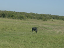
Big Marine Lake - Minnesota
So the map for this post comes from Lesson 4 in the Bolstad book. In order to make this map, I had to georeference four different aerial images; three were from 1938, and one was from 2008. From these georeferenced images, I was able to create two shapefiles that show the shoreline of Big Marine Lake in Washington County, Minnesota. The comparison of the two resulting shapefiles shows the increase in the lake's area in the decades since the Dust Bowl. Enjoy!

Maps, man!
The top map shows elevations calculated by using three different methods of interpolation, as shown in each data frame. The bottom map shows the differences between calculated and actual elevations for each method.


Monday, February 11, 2013
I'm bAAAAAAAAAAAAAck!!!!!!!!1
So, apparently, I'm back at the GIS Blogging once again! This time,
the blog will focus on my exploits in my GRADUATE LEVEL Advanced GIS
Class with Prof. Rosanna Rivero! I am excited to fire the old blog back
up and bring it into Grad School at the University of Georgia! More
posts to come ASAP, but for now, it's back to making maps!
Adieu!
Cam
PS: You know I cannot put an entry on this page without one of my signature links. Enjoy!
Adieu!
Cam
PS: You know I cannot put an entry on this page without one of my signature links. Enjoy!
Wednesday, May 5, 2010
Analysis of the Macon Bus System in the College Hill Corridor
Authored by: Batts and Yearty
Published: Cinco de Mayo, 2010

.jpg)
To begin our project, we determined that we wanted to map out the bus stops and routes of Macon, Ga. After a quick assessment of the city and the Macon Transit Authority's (MTA) bus system, we narrowed our mapping site down to the College Hill Corridor. The College Hill Corridor, from here defined as “the Corridor,” is a section of Macon stretching from Mercer University's Historic Campus, further identified as “the Campus,” through the downtown area. It mainly follows College Street, Forsyth Street, Washington Avenue, Poplar Street, and Mulberry Street. The idea behind the Corridor is to promote student involvement in downtown Macon, and invite the greater community to invest in and around their city. The main goal of our project was to create data that previously did not exist, or was at least not available to the public, that showed the location and accessibility of bus stops in the Corridor.
In order to project the location of the bus stops into our Geographic Information System, or GIS, we utilized Mercer University's Trimble mapping hand-held GPS units. These units run a version of Microsoft Windows and use TerraSync software to map any point, line, or polygon to within a one to three meter radius. Our task was to go out and physically map these locations with the unit.
After driving madly throughout downtown, Joseph successfully managed to keep us alive, and we began to input our newly mapped data into our GIS. From here we began to add data layers that were provided to us through the Georgia GIS Data Clearinghouse, Mercer University Professor Dr. Brian Rood, and Mercer University GIS Lab Assistant Leslie Ouy. We included satellite imagery, landmark outlines, roads, and railroads to assist with familiarization of the location of the bus lines and bus stops. We utilized ArcMap GIS software to compile these layers as well as to georeference the physical location of all added features.
From our maps, we extrapolated that the bus system seems to be better designed to transport people FROM downtown Macon rather than TO destinations in downtown. The lack of a singular route to connect Mercer's Campus to the eastern half of downtown is a point of weakness in the bus system. This weakness causes MTA patrons to pay more in bus fare because of the need to transfer, thereby deterring passengers who would otherwise opt for public transportation over personal. Furthermore, we included within our GIS the conditions of the bus stops. For the most part all that existed was the sign indicating the bus stop. Only one stop out of twenty-three was covered and only one other had a bench and trash receptacle. Two were even lacking sidewalk access leaving patrons to wait in the grass or on the street for the bus, a terrible situation for the disabled community. This leaves nineteen bus stops in our GIS with only signage on a sidewalk. The aesthetic value of the city is decreased by the lack of creative design associated with these bus stops.
In preparing our GIS, we hope that the MTA will take into account our findings. We propose two improvements that we believe would make the bus system more rider friendly. The first is to add a new bus route (or alter an existing one; Route 5 would be the most likely candidate) that would stretch from Mercer's Main Campus across to the businesses on Riverside Drive in order to better incorporate the entirety of the College Hill Corridor. Secondly, we propose that the MTA make the bus stops more rider friendly and improve pedestrian access to the stops. Locating stops on a sidewalk, with a bench, and under some type of covering for occasions of inclement weather would likely increase ridership among Maconites, and would not hurt the system's image with respect to Mercer University Students. More aesthetically pleasing stops would also help the image of the bus system. Themed stops, such as one modeled on the annual Cherry Blossom Festival, are one avenue to pursue. In conclusion, we believe that the MTA bus system has a way to go before it can be considered an efficient, effective, and desirable mode of transportation for a majority of downtown residents and visitors.
Special thanks to: Georgia GIS Data Clearinghouse, Dr. Brian Rood, and Leslie Ouy!
Tuesday, April 13, 2010
New, Cam-Made Maps!!!
Here are two maps that I created all by myself!
The first map is one that I created earlier today. It will be appearing in a research article looking at kaolinite deposits in Georgia:
 The second map is one I created for my Epidemiology course. It shows the prevalence of different species of Hantavirus all over the world. Just some forewarning, the map is pretty flawed. Luckily for my group and me, our professor just took a quick glance at it and did not ask for the file afterwards. Let's have a little contest to see who can find all of the flaws in the map:

And finally, for those of you who follow this blog religiously, don't.
There is nothing particularly funny about that, just a hint of what I will be up to in the not-so-distant future .
Ciao,
Cam
The first map is one that I created earlier today. It will be appearing in a research article looking at kaolinite deposits in Georgia:


And finally, for those of you who follow this blog religiously, don't.
There is nothing particularly funny about that, just a hint of what I will be up to in the not-so-distant future .
Ciao,
Cam
Thursday, March 18, 2010
The Day The Irish Slept In...
Howdy guys and gals! Here's to my first posting in March! What you will find below is a map I created today of the largest land owners of Gulf County Florida. The point of making this map was to learn how to Join and Relate databases (i.e. Excel, .csv files) with existing maps of an area. I think it's pretty cool to know how to do that. If you have any questions about it, just leave them as a comment and I will respond!

When you are finished admiring this awesome map, check this out. When you are done with that, how about this. And for a final hoorah today, check out this!!!

When you are finished admiring this awesome map, check this out. When you are done with that, how about this. And for a final hoorah today, check out this!!!
Subscribe to:
Comments (Atom)
